This is a great resource I found at peakvalleyrisk.com, this great work. We can all use this to review the simulated risk area from Derbyshire through Cheshire and up to the North Wirral coastline. There is an interactive map of the whole pipeline you can zoom into your area of interest and see your simulated risk. Interactive Map
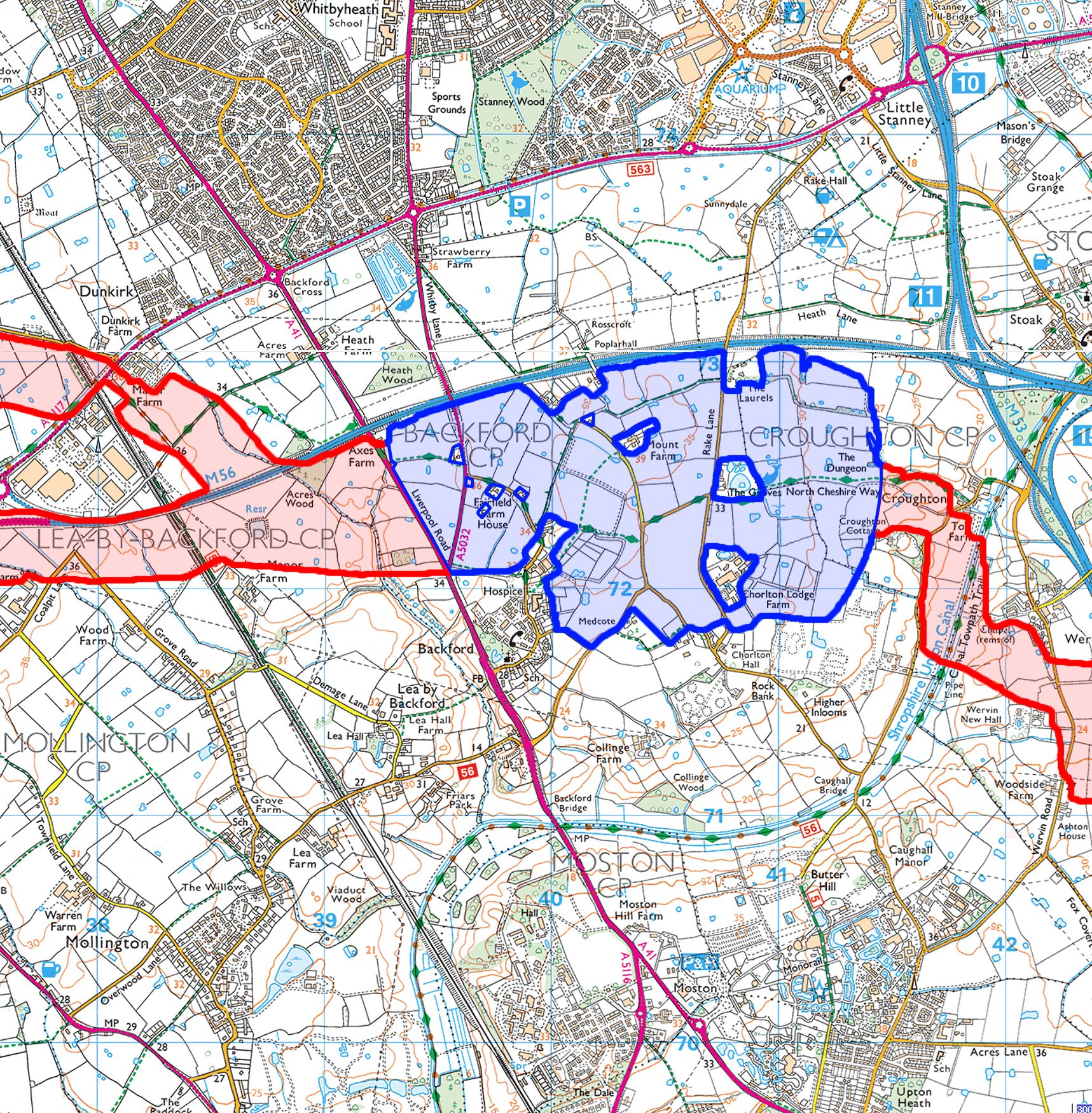
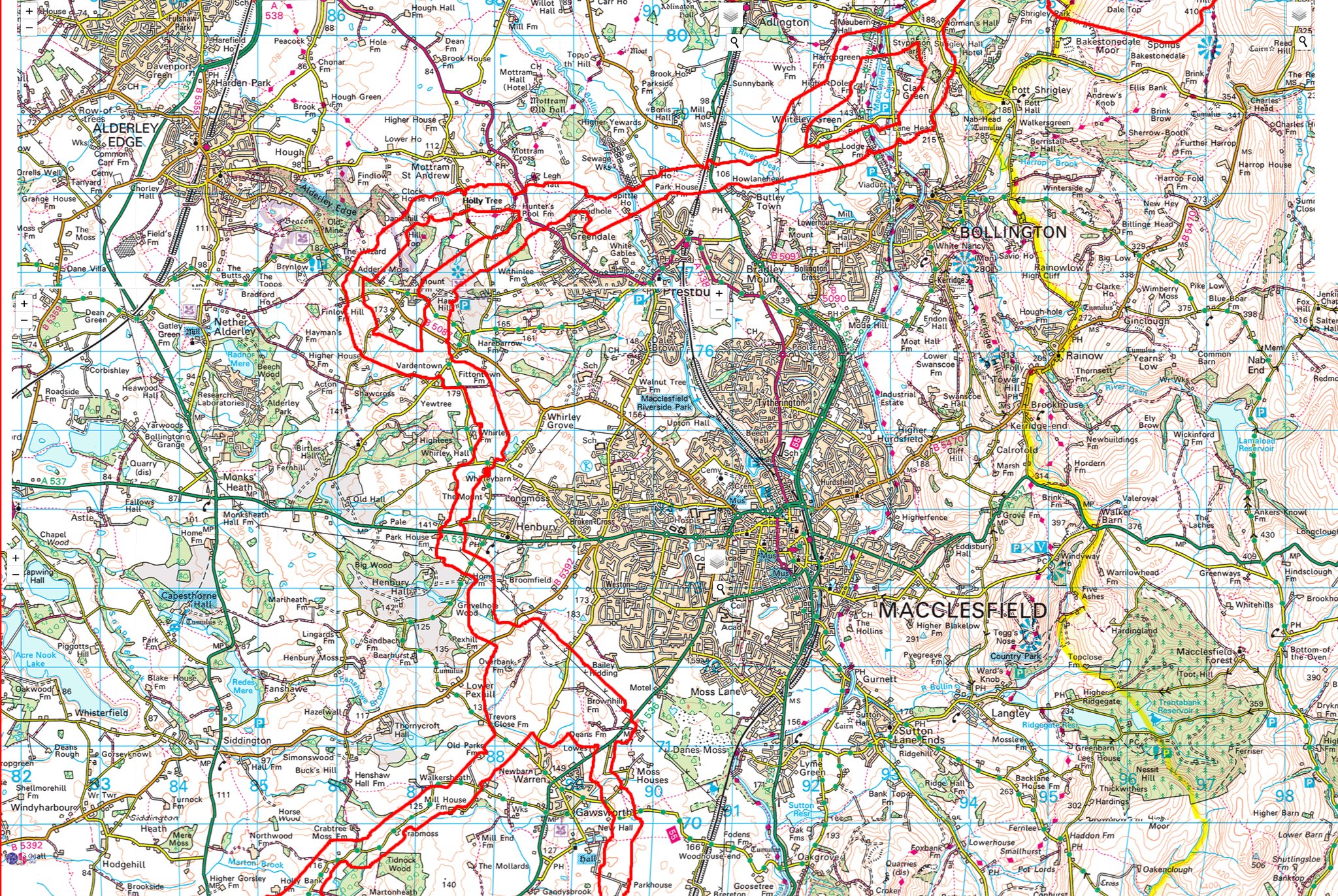
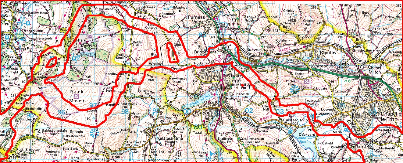
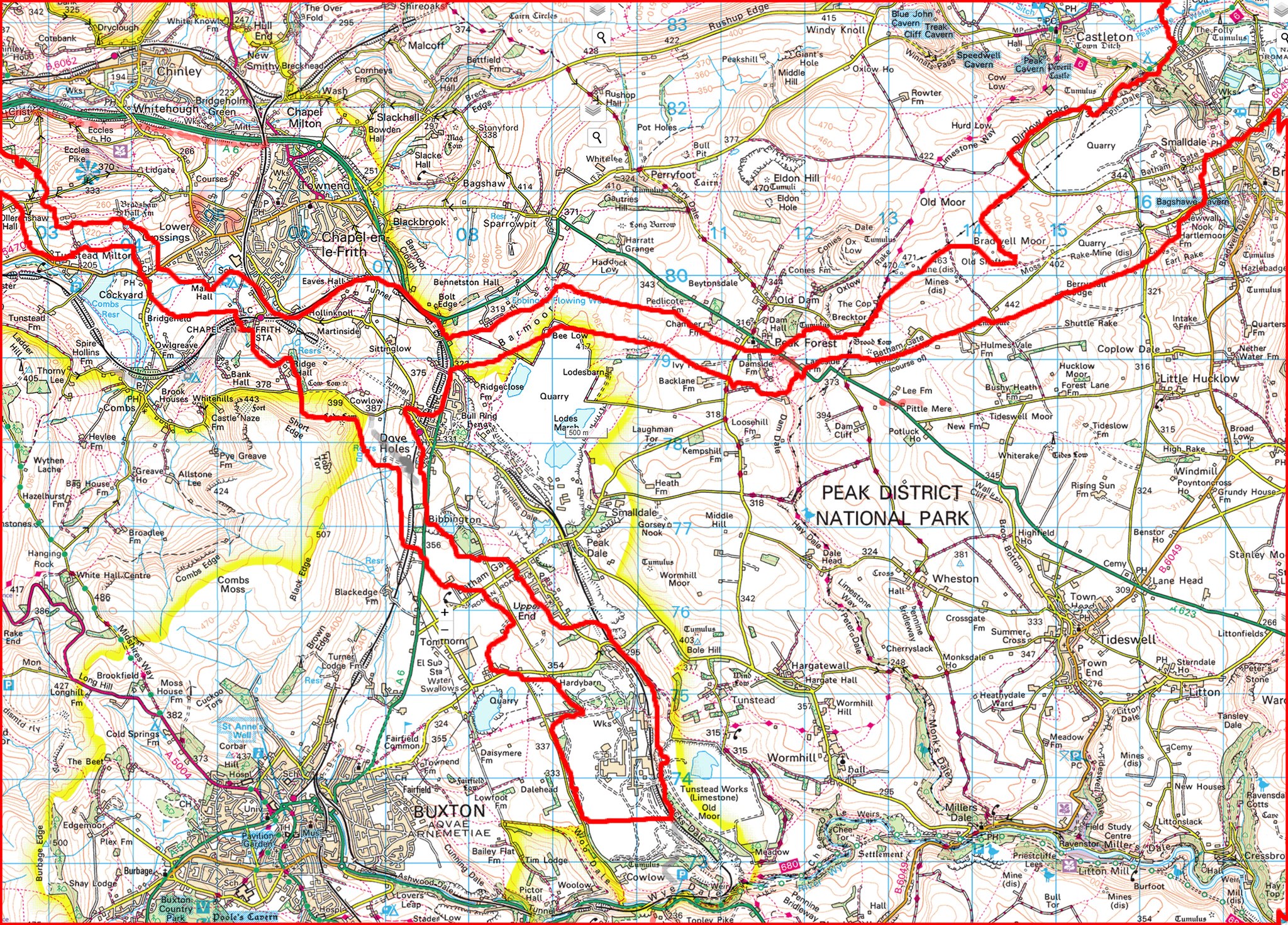
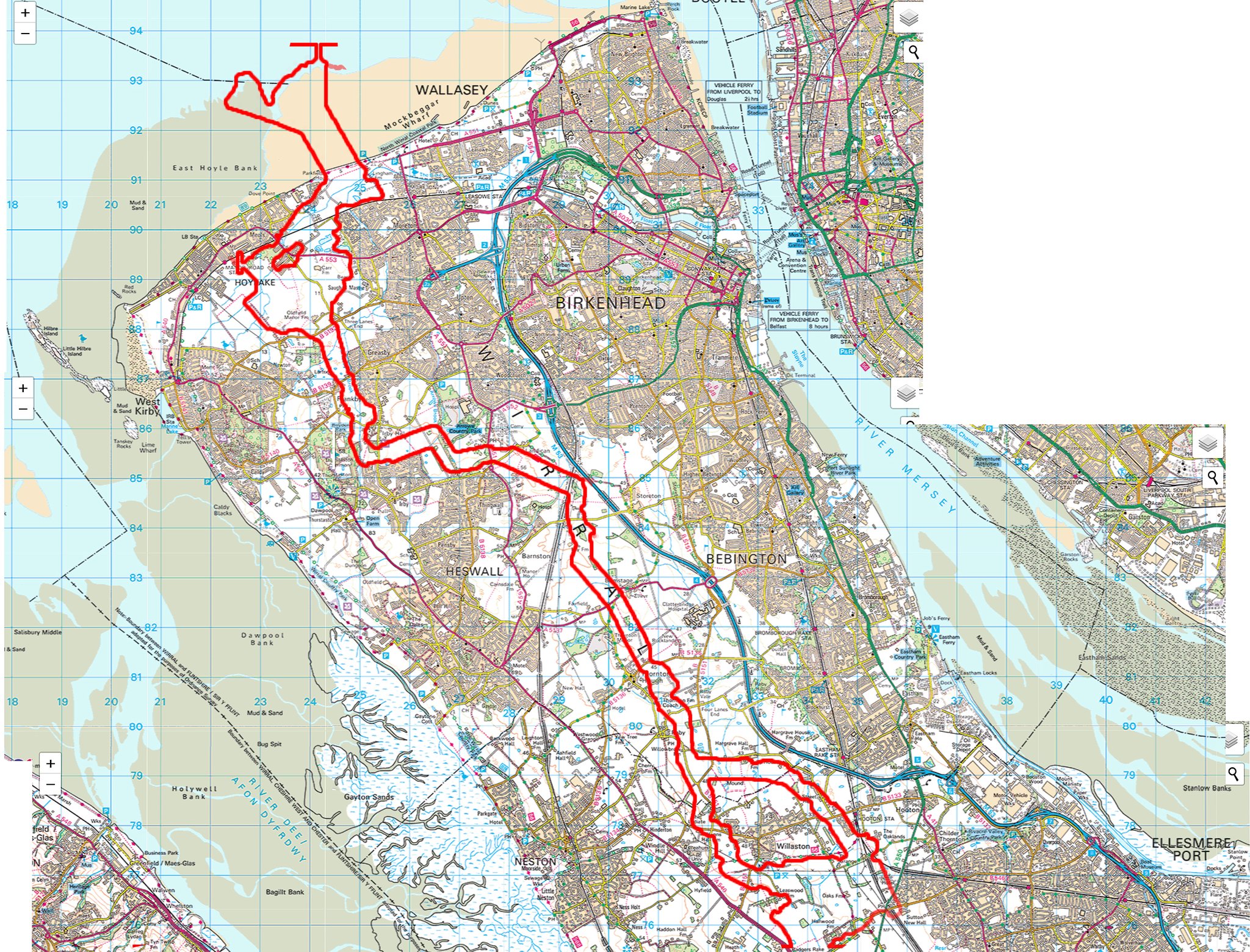
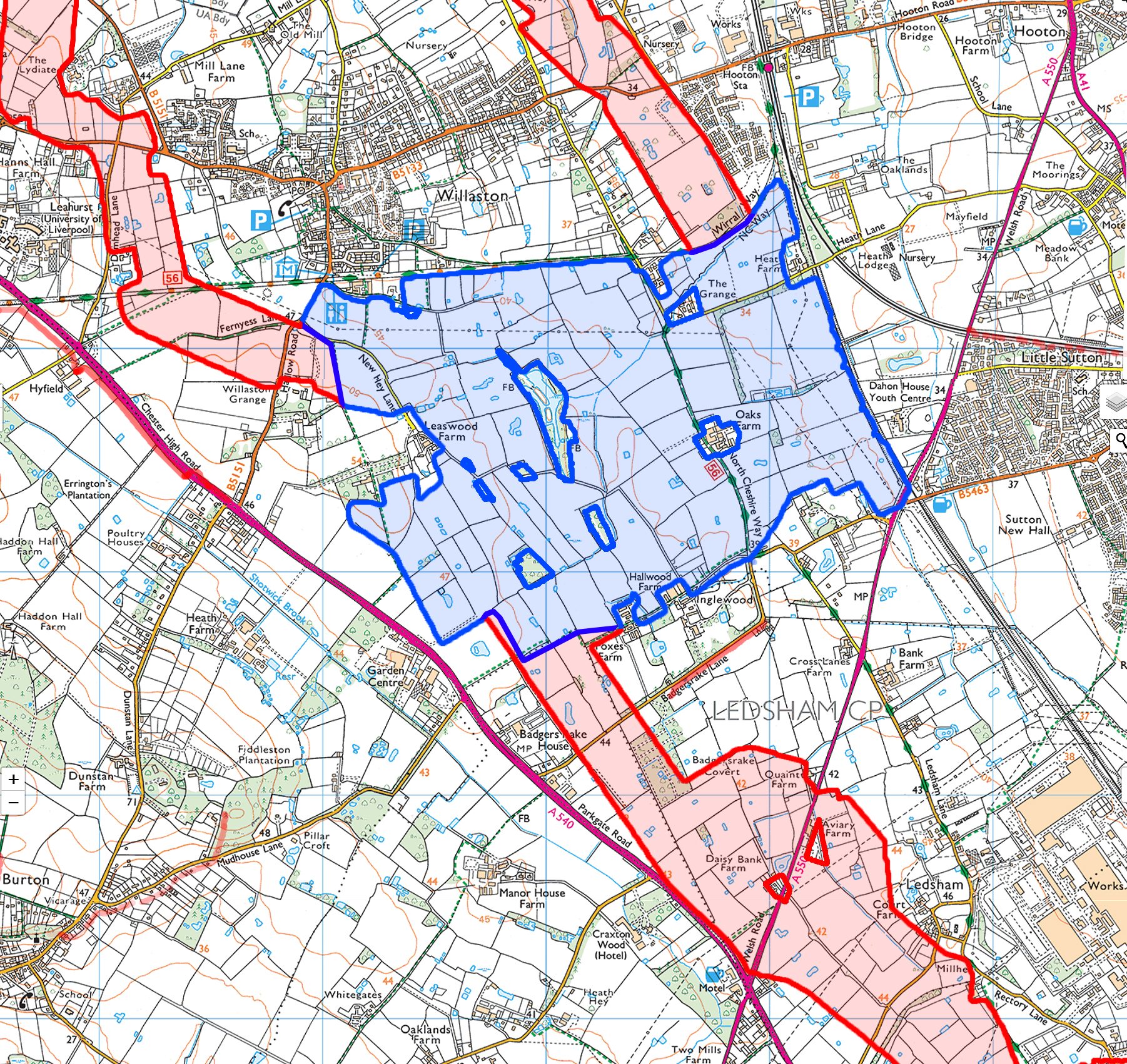
| This section below shows the proposed pipeline routes overlaid on OS maps. This is the work of Simon Chamberlain | |
|---|---|
|
|